Reading an estuary
Estuaries are partly enclosed waters influenced by coastal water and freshwater. Their depth, exposed area, currents, salinity, and wildlife access shift with tides, river flow, weather, and season.
Last updated
Trace where waters and landforms connect
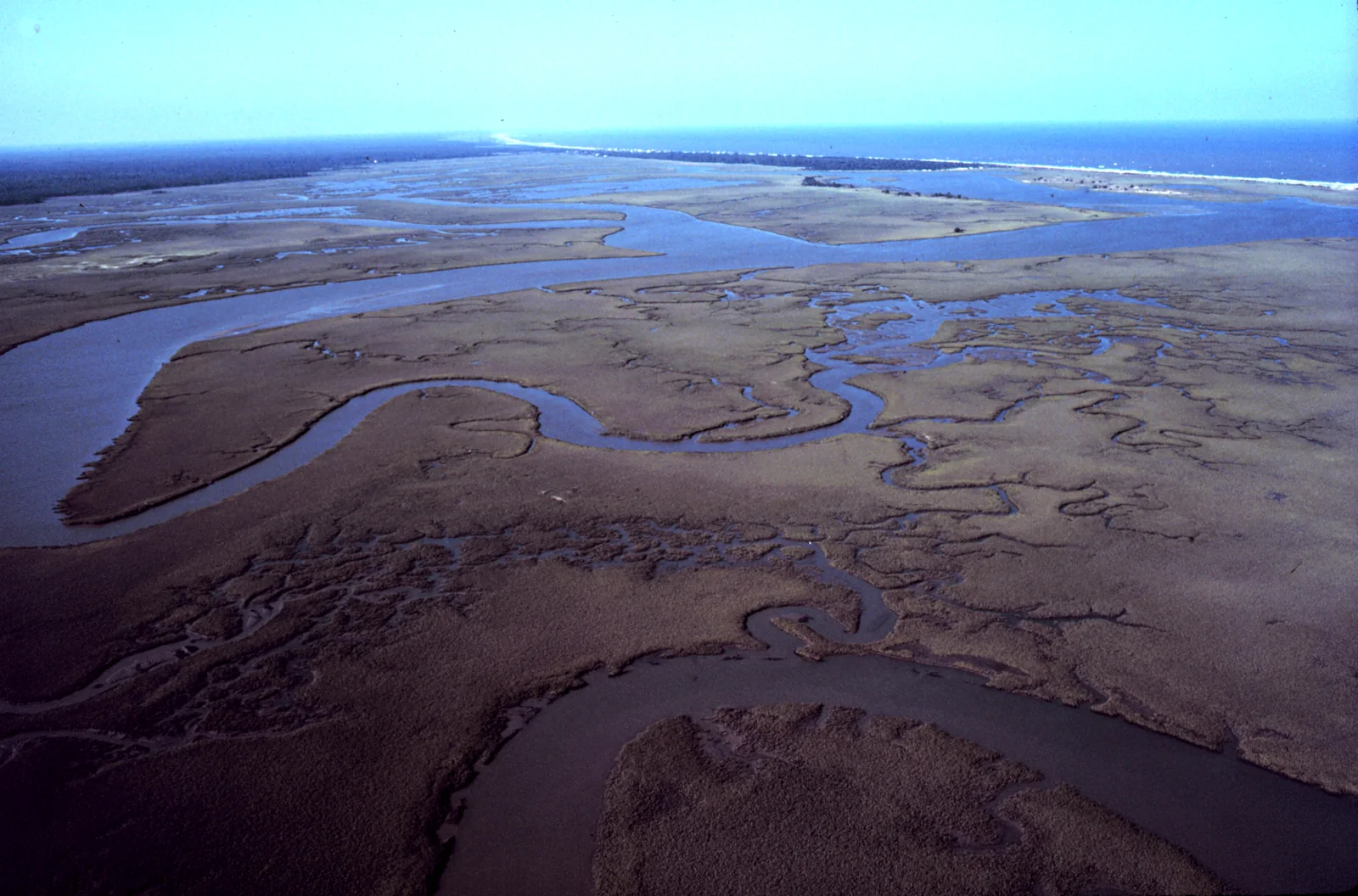
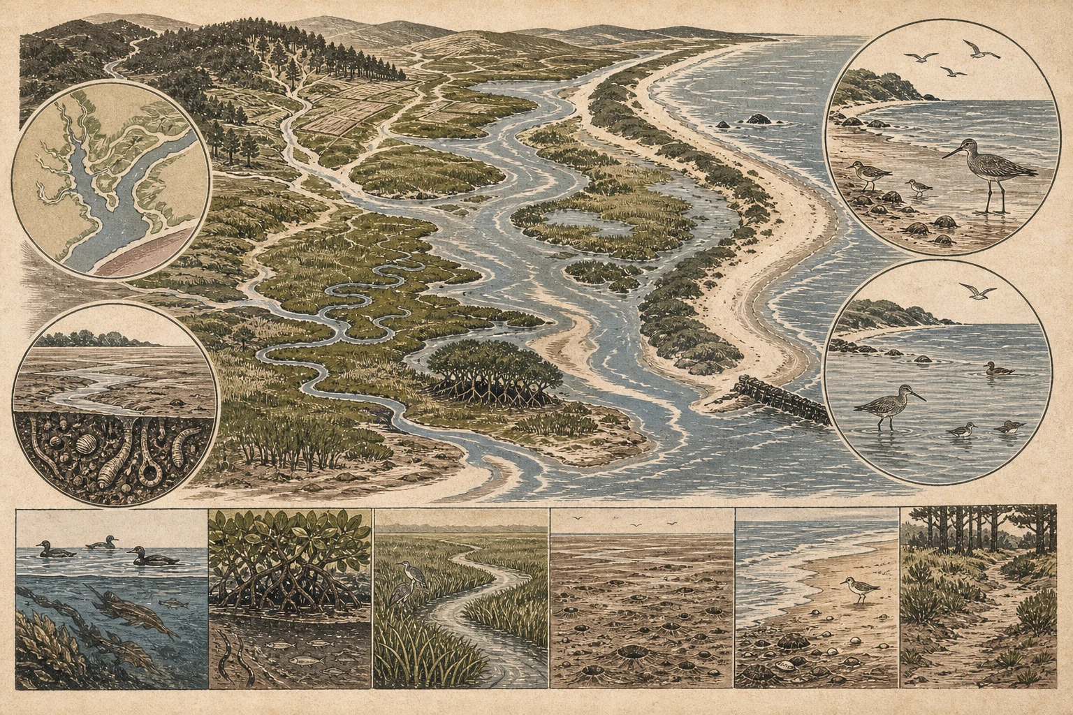
Using a local chart or map alongside a permitted coastal overlook, identify where rivers or creeks enter the basin, where the inlet or mouth connects to the open sea or large lake, and how sand spits, barrier islands, rocky headlands, or jetties shelter the enclosure. Next, trace the internal habitat mosaic: deep subtidal channels, sinuous dendritic tidal creeks, cordgrass salt marshes or mangrove fringes, oyster reefs, eelgrass beds, and intertidal flats. Because estuaries include drowned river valleys, bar-built lagoons, tectonic bays, and fjords, read the local basin geometry rather than expecting one standard layout. [1][2][3]
- Use local habitat names while recording the visible feature they describe.
- Note culverts, tide gates, levees, docks, and dredged channels separately.
- Treat mapped boundaries as context, not proof of present water conditions.
Let the tide redraw the scene
In tidal estuaries, the habitat map completely reorganizes every few hours. An ebbing tide uncovers glistening mudflats, sandbars, oyster beds, and creek banks rich in polychaete worms, amphipods, clams, and fiddler crabs, spreading shorebirds, herons, and gulls across wide foraging expanses. As the flood tide returns, rising water submerges those flats, carries forage fish into flooded marsh edges, and compresses thousands of sandpipers and plovers onto high-tide roost spits and salt-marsh islands. Always check a local tide station and avoid walking toward contracting high-tide roosts where flushed birds have nowhere else to rest. [1][3][4]
- Record predicted and observed tide stage with the observation time.
- Watch how channels fill and flats disappear without walking onto sensitive sediment.
- Keep distance from feeding and roosting flocks as available ground contracts.
Treat salinity as a moving gradient
Estuarine salinity typically grades from fresh or oligohaline water near the river mouth through brackish mesohaline mixing zones to polyhaline water near the ocean inlet, and denser saltwater often slides beneath lighter freshwater in a vertical wedge. That salinity gradient shifts upstream and downstream with spring and neap tides, storm surges, summer droughts, and watershed flood pulses. While salt-marsh plant zonation and oyster or barnacle distributions reflect long-term salinity patterns, you cannot read exact parts-per-thousand salinity by eye—so log recent rainfall and river discharge context without guessing numerical values. [1][2][5]
- Do not infer exact salinity from one plant or animal sighting.
- Keep measurements with instrument, units, depth, place, and time.
- Expect the same point to differ across tides and seasons.
Compare the habitat mosaic repeatedly
Scan each estuarine zone in a consistent sequence—open bay water, tidal creek mouths, exposed mud or sand flats, marsh or mangrove edges, shell bars, and upland buffers—recording whether birds, seals, otters, fish, or crabs are foraging, loafing, or commuting with the current. Revisit the exact same boardwalk or bluff at contrasting tide stages to see how the same acre swaps diving ducks and harbor seals at high water for probing curlews, dowitchers, and egrets at low water. Keep notes on wrack lines, turbid plumes, or stranded organisms factual rather than jumping to pollution diagnoses. [2][3][4][5]
- Attach photographs and wildlife counts to tide, weather, route, and duration.
- Stay on permitted overlooks, boardwalks, beaches, or launch areas.
- Report spills or unusual mortality through the appropriate local channel.
Related guides
Get Fauna and identify it in the field.
Where this guide comes from
Source-checked editorial guide. Last updated . This guide teaches identification and field skills; it is not a substitute for expert verification when it matters.