Reading an urban park
Urban parks are habitat within a larger city network, not isolated green islands. Vegetation layers, water, patch connections, buildings, lighting, noise, people, and pets all help explain where wildlife is noticed.
Last updated
Map patches and connections beyond the gate
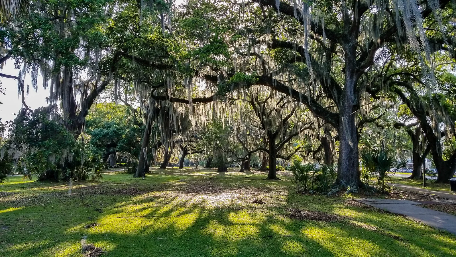
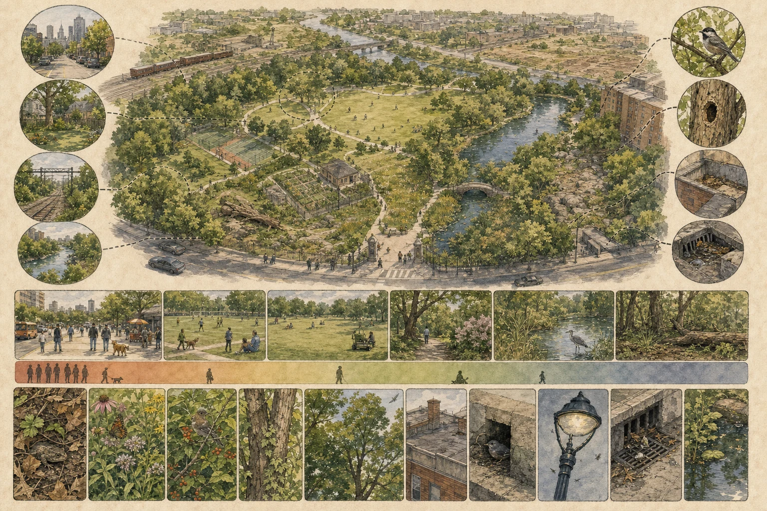
Begin by mapping the internal mosaic of the park: mature tree groves, shrub borders, unmown meadow strips, manicured turf, pollinator beds, ornamental ponds, dead snags, stone walls, and pavilions. Next, trace how the park connects across the city grid through street-tree canopies, residential gardens, railway embankments, cemeteries, and stream corridors. U.S. Forest Service urban wildlife research shows that surrounding canopy connectivity and neighborhood matrix structure strongly influence which migratory songbirds, bats, and mammals reach a park—even though a line of street trees that helps flying birds may still leave ground mammals blocked by multi-lane avenues. [1][2][3]
- Sketch gaps as well as links between vegetation patches.
- Note barriers such as wide roads, walls, lighting, and channelized water.
- Keep public and inaccessible habitat distinct on the map.
Compare a human-use gradient
Select three or four permitted observation stations that span the park's human-activity gradient—from a paved plaza, dog-walking lawn, or athletic field to a tucked-away shrub corner, wooded ravine, or vegetated pond margin. Conduct equal ten-minute counts at each point, logging pedestrians, joggers, leashed and off-leash dogs, groundskeeping machinery, traffic noise, and wildlife behavior. Studies of human footprint and wildlife space use show that many animals shift their timing or retreat into dense cover during peak visitor hours, so a quiet midday lawn count may reflect temporal avoidance or low cover rather than permanent absence. [1][3][4]
- Repeat comparisons at similar times on more than one day.
- Separate animals feeding or resting from those merely passing through.
- Do not enter planted beds or closed areas to equalize your view.
Read vertical structure and urban resources
Scan every vertical layer and built microhabitat systematically: leaf litter under shrub beds, flowering perennials, tree trunks, woodpecker or natural decay cavities, high canopy crowns, bridge girders, building ledges, streetlamp housings, and stormwater basins. City wildlife exploits a mix of native oak and hackberry foliage, ornamental winter berries, masonry nesting ledges, leaky irrigation heads, and spilled food—yet responsible urban observation never crosses into hand-feeding or baiting. Artificial provisioning concentrates animals unnaturally, alters foraging behavior, increases disease transmission and aggression, and habituates wildlife to approaching people and pets. [1][4][5]
- Note the resource used without assuming it is beneficial overall.
- Watch cavities and nests from a distance and avoid repeated close checks.
- Secure food and trash and never bait wildlife for a photograph.
Repeat a route that others can understand
Establish a repeatable loop along public paths or a set of fixed five-minute point counts, recording start time, duration, distance, weather, leaf phenology, flowering or fruiting stages, pond water level, artificial night lighting, and visitor density. Include indirect field sign—squirrel dreys, hawk plucking posts, raccoon prints in muddy basin margins, and unidentified warbler chips—alongside confirmed species sightings. Standardizing your effort turns casual park strolls into a seasonal natural-history record that tracks spring migration stopovers and winter waterfowl arrivals while keeping sensitive owl roosts or active nests safe from crowd pressure. [1][2][4][5]
- Keep stationary observations separate from species seen while walking.
- Record zero observations for a timed point instead of deleting the visit.
- Follow park rules and give wildlife room to continue normal behavior.
Related guides
Get Fauna and identify it in the field.
Where this guide comes from
Source-checked editorial guide. Last updated . This guide teaches identification and field skills; it is not a substitute for expert verification when it matters.
- U.S. Forest Service — Urban Wildlife ↗
- U.S. Forest Service — Urban tree canopy connectivity ↗
- U.S. Forest Service — Urbanization, fragmentation, and wildlife communities ↗
- U.S. Geological Survey — Human presence and animal space use in national parks ↗
- National Park Service — Seven Ways to Safely Watch Wildlife ↗