Building a seasonal photo station
A seasonal photo series is credible when the camera returns to the same place, height, direction, focal length, and framing on a stated schedule. Stable landmarks, careful station notes, original files, and matched metadata make change visible without overstating it.
Last updated
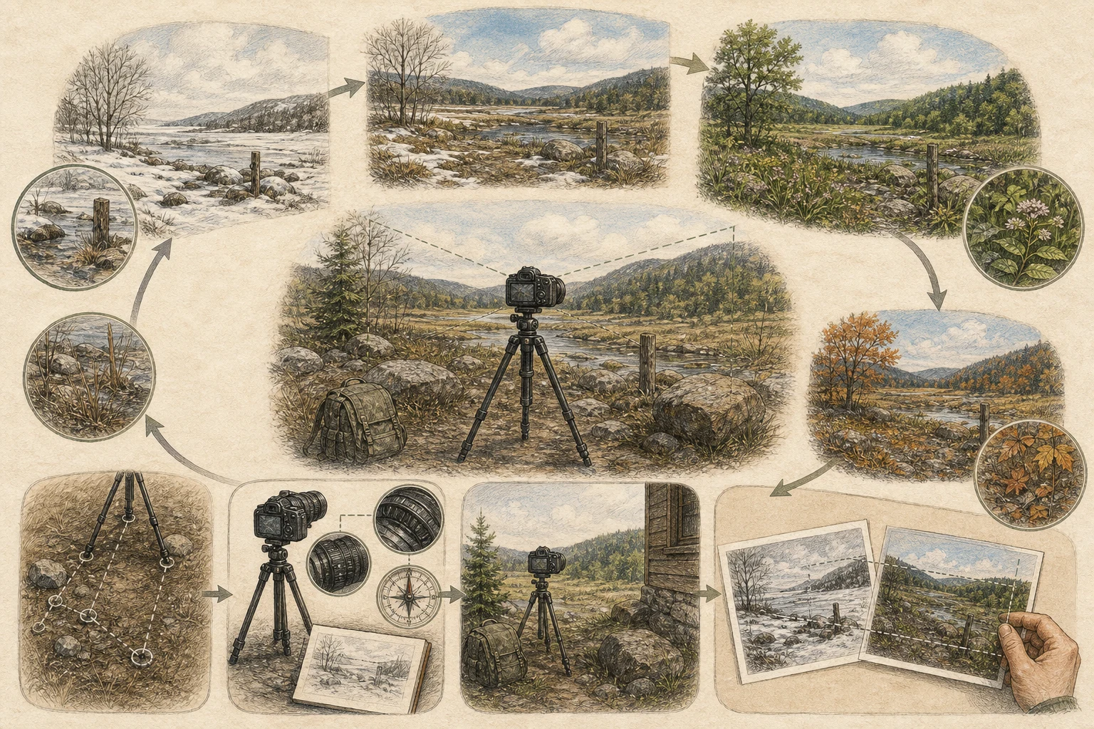
Choose a station you can reoccupy
A great seasonal photo station needs a camera spot you can find again when winter snow buries the grass or midsummer brambles surge waist-high. Pick a legal, safe viewpoint anchored to an immovable existing feature—a notched boulder beside a vernal pool, the northeast corner post of a wetland boardwalk railing, or a trail bridge abutment—so you never need to hammer unauthorized stakes or paint marks onto public land. Frame a view that includes both the living subject you want to watch (a floodplain willow stand, a tidal marsh channel, or a single oak crown) and fixed skyline rocks or tree trunks that anchor the edges. [1][2][3]
- Anchor your camera spot to an existing permanent feature like a boardwalk corner post, bridge rail, or bedrock notch.
- Ensure the spot remains legally and safely accessible during winter snow, spring high water, and summer growth.
- Never drive rebar stakes, nails, or paint marks into trees or public land without written land-manager permission.
Record geometry, not just coordinates
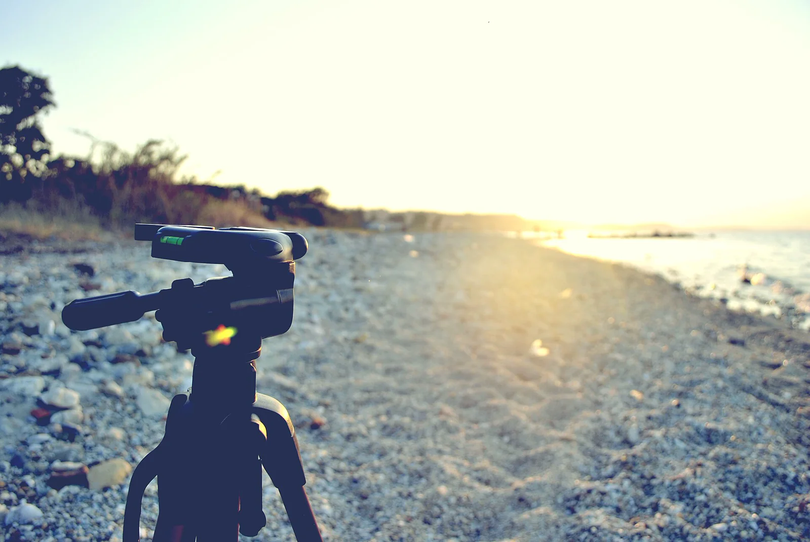
Consumer smartphone and handheld GPS coordinates typically drift by 3 to 10 meters—more than enough error to shift foreground branches across your entire frame. To make your station truly repeatable, write down the exact camera height above the ground or railing, the compass bearing of the lens, the focal length (such as a standard 1x phone lens or 35mm camera setting without digital zoom), and which immovable landmarks touch the left, right, top, and bottom borders of your viewfinder. Step back five paces and take one 'station finder' photo showing your tripod or standing spot in its surroundings for future reference. [1][3][4]
- Log exact camera height, compass bearing, and fixed focal length (such as 1x wide or 35mm) alongside GPS coordinates.
- Note specific immovable rocks, posts, or distant ridge notches that touch the four edges of your initial frame.
- Take one step-back reference photograph showing the standing spot itself so you can relocate it in any season.
Set a calendar before change happens
If you only photograph a wetland or woodland edge when dramatic autumn foliage or a rare snowstorm catches your eye, you will miss the subtle weeks of budbreak, sedge green-up, and summer water drawdowns that connect those moments. Tie your visits to a regular rhythm—such as the first weekend of every month at 9:00 a.m., or weekly during spring leaf-out and amphibian breeding—and carry a laminated copy or phone album of your baseline frame into the field so you can match the horizon line and corners on the spot. Log date, time, sky condition, and recent rain or frost with each shot. [2][3][5]
- Commit to a regular calendar rhythm—such as monthly or biweekly at a similar hour of day—before the season begins.
- Bring your baseline reference image into the field on your phone to align horizon height and corner landmarks before shooting.
- Record date, time, cloud cover, and recent weather events like heavy rain, drought, or frost with every frame.
Match first, interpret second
Archive your full-resolution original files using a clear, sortable naming pattern—such as `StationName_YYYY-MM-DD_HHMM`—so years of visits stay in chronological order. When laying spring, summer, autumn, and winter frames side by side, check your fixed rock or post landmarks first to verify that an apparent change in shoreline width or shrub height is not simply an artifact of a slightly wider phone lens, a tilted horizon, or harsh low-angle winter shadows. Describe what the sequence visibly proves—such as the week willow catkins opened or when the vernal pool dried—while recognizing that understanding why a change occurred requires broader field measurements. [1][3][4]
- Save uncropped original files with `SiteName_YYYY-MM-DD` filenames so the chronological series stays intact.
- Verify alignment against immovable rocks or posts before attributing differences to erosion or plant growth.
- Separate differences caused by sun angle, focal length, or water reflection from true phenological or habitat change.
Related guides
Get Fauna and identify it in the field.
Where this guide comes from
Source-checked editorial guide. Last updated . This guide teaches identification and field skills; it is not a substitute for expert verification when it matters.
- National Park Service — Repeat Photography Methods ↗
- USA National Phenology Network — Nature's Notebook Documentation ↗
- U.S. Forest Service — Photo Point Monitoring Handbook ↗
- U.S. Geological Survey — Metadata Creation ↗
- National Park Service — Capturing Natural Resource Change Through Repeat Photography ↗